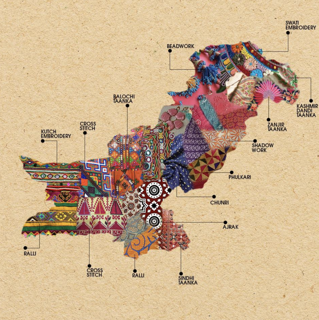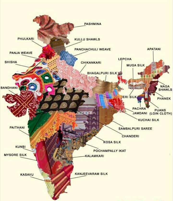
Journalist Saima Mir posted to Twitter this “map of Pakistan showing the embroidery techniques of its regions.” And, sure enough, it led to someone surfacing a corresponding map of Pakistan’s neighbor, India. The underlying message of the maps? It’s to show, as @AlmostLived noted, “how diverse elements come together to make beautiful things.” The map above was originally produced by Generation, a Pakistani fashion company. We’re not clear on the origin of the India map, unfortunately.

If you would like to sign up for Open Culture’s free email newsletter, please find it here. It’s a great way to see our new posts, all bundled in one email, each day.
If you would like to support the mission of Open Culture, consider making a donation to our site. It’s hard to rely 100% on ads, and your contributions will help us continue providing the best free cultural and educational materials to learners everywhere. You can contribute through PayPal, Patreon, and Venmo (@openculture). Thanks!
Related Content:
New BBC Dramatization of Salman Rushdie’s Midnight’s Children Now Streaming Free for a Limited Time
Pakistani Musicians Play an Enchanting Version of Dave Brubeck’s Jazz Classic, “Take Five”
Introduction to Indian Philosophy: A Free Online Course
India’s Answer to M.I.T. Presents 268 Free Online Courses (in English)


Really good to see though I think there is much more overlap between neighbouring states/provinces in the two countries.
Just to clarify, I had originally posted the two maps first and days before Saima Mir saw it on my post.
I saw the Indian map first several days ago, then my daughter found the Pakistani.
Being an Indian-Pakistani I found it natural to put them together especially on 14/15 August. I have never wished for Independence Day to India and Pakistan separately for past 27 years.
Saima got back to me to ask its source. I just suggested to her to please share both instead of only Pakistan’s.
Here is my original link. https://www.facebook.com/quraishi.ilmana/posts/1635223213156907?pnref=story
Indian maps, confusing weather its weaves, embroidery, painting, printing / texture.
In Gujarat most important textile is Patan Patola ( Double Ikat ).
Confusing map
Bandhni , kalamkari and different weaves are not embroidery.
If it is textiles, Patan Patola (double Ikat ) from Gujarat is very important textile.
I’m a little disappointed to see that the maps are not fabric but photoshopped.
I can’t even begin to imagine how many textiles would’ve been destroyed to make a map such as this one! I’m absolutely fine with the photoshop versions for that very reason.
Jamdani is from Bangladesh. West bengal is famous for tant ..
“Craft”, not all are “embroidery”. Please fix the title.
I wonder Why Bangladesh (East Bengal as in those days) is left out of the Map ?
Is there a particular Reason as to Why ?
A miss leading Indian map.
The style Jamdani is originated and mostly practiced in Bangladesh , not In west Bengal.UNESCO has recently declared Traditional art of Jamdani weaving as Intangible cultural heritage Mentioning Bangladesh as the state party of Origin.(https://ich.unesco.org/en/RL/traditional-art-of-jamdani-weaving-00879)
The cross stitch embroidery shown on Pakistan map, south next to the Ralli , is not Pakistani work, it’s surely cross stitch but it’s a known Palestinian motif. Perhaps they didn’t read the title well since they both start with a “P”
:D
Under a Grand Title,”Open Culture” I was saddened by the petty comments that were made!
I was happy to see the depictions of India and Pakistan in ‘fabric’ and ‘stitches’.
Unless this was. PhD assignment, enough of the critisim.
Embroidery, fabric, art, craft?
India first? Pakistan, no Bangladesh?
Creative people don’t negatively criticize the work of other creative people!
Can you advise how and where to purchase colorful map of Indian textiles