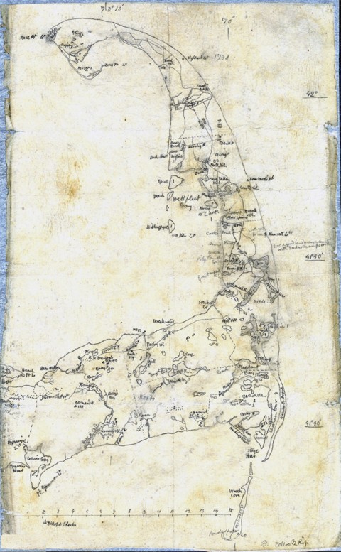
Henry David Thoreau wrote in 1866:
“Wishing to get a better view than I had yet had of the ocean, which, we are told, covers more than two thirds of the globe, but of which a man who lives a few miles inland may never see any trace…I have spent, in all, about three weeks on the Cape; walked from Eastham to Provincetown twice on the Atlantic side, and once on the Bay side also…but having come so fresh to the sea, I have got but little salted.”
You can click the image above to see it in a larger format. For many other maps made by Thoreau, visit the “Thoreau Lands and Property Survey” collection at the Concord Free Public Library. Also find works by Thoreau in our collection of Free eBooksand Free Audio Books.
If you would like to sign up for Open Culture’s free email newsletter, please find it here. It’s a great way to see our new posts, all bundled in one email, each day.
If you would like to support the mission of Open Culture, consider making a donation to our site. It’s hard to rely 100% on ads, and your contributions will help us continue providing the best free cultural and educational materials to learners everywhere. You can contribute through PayPal, Patreon, and Venmo (@openculture). Thanks!


Leave a Reply